OpenStreetMap vs Google Maps: Which Is Better?
If you’re looking for an in-depth OpenStreetMap vs Google Maps comparison, you’re in the right place.
Here, you’ll discover the differences between these two map platforms. And if you have doubts about which is better, this article will give you all the information you need to make an informed decision.
Google Maps doesn’t need much introduction. After all, it is one of the most popular mapping apps in the world.
OpenStreetMap (OSM), meanwhile, doesn’t enjoy such popularity. It has about 10.2 million active users, compared to Google Maps’ one billion.
On the other hand, at the base of many apps and websites used by billions of people is OpenStreetMaps. The most popular examples of such platforms are Facebook, Amazon, and Uber.
The open-source map dataset provides users with free geospatial data and is continuously updated by its users.
Now, let’s explore both apps in more detail:
OpenStreetMap vs Google Maps
In many ways, OpenStreetMap is very different from Google Maps, with the core differences highlighted in the table below.
| Feature | OpenStreetMap | Google Maps |
| User-friendliness | Not intuitive | User-friendly |
| Data accuracy | Inconsistent | High |
| Voice-guided navigation | No | Yes |
| Target audience | Developers | Average internet user |
| API access | Free | Paid |
| Mobile app | No | Yes |
The two map platforms allow you to get the same information despite their differences.
Having said that, some information and features are only available with Google Maps and vice versa.
That’s why we’ll explore Google and OSM mapping experience in more detail.
After reading this OpenStreetMap vs Google Maps comparison guide, you’ll be able to make an informed decision about which service better meets your requirements.
OpenStreetMap vs Google Maps – Features
The following sections will closely examine the core features of the two map services.
We’ll start with the user interface, and then move on to their navigation capabilities, route planning, customization, and mobile apps.
User Interface
One of the many differences between OpenStreetMap and Google Maps is the user interface.
Perhaps, the reason why OSM isn’t that popular is its interface. It’s similar to Google Maps, but looks like an outdated version of it.
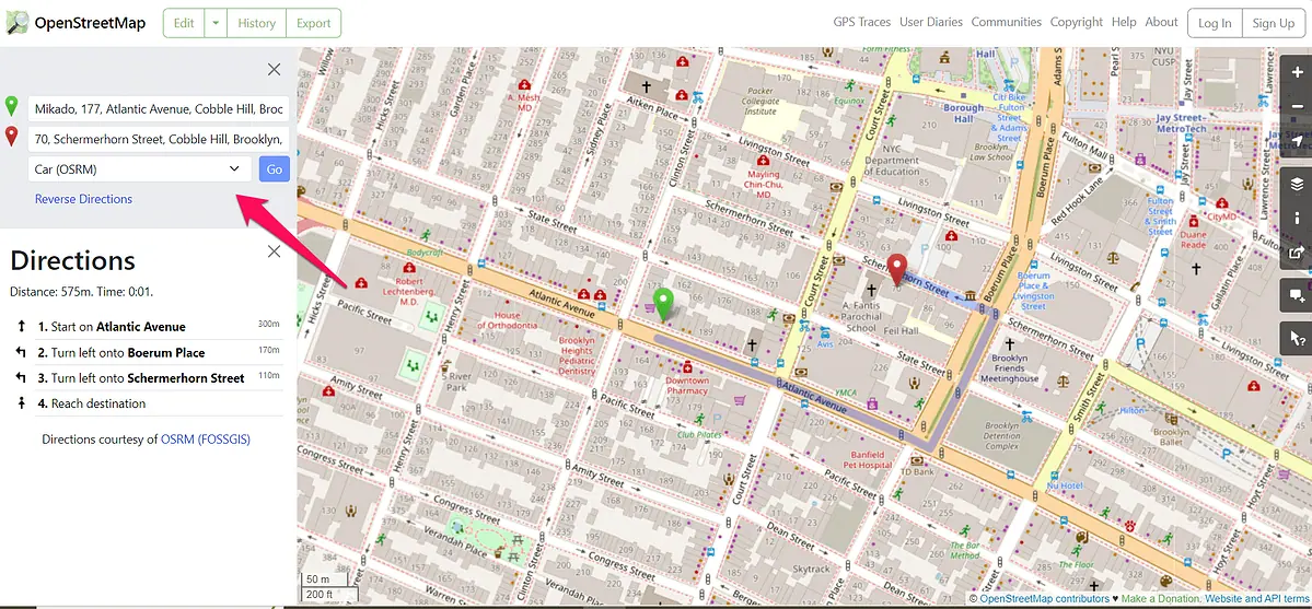
On the left side of the screen, you can set your starting point and destination.
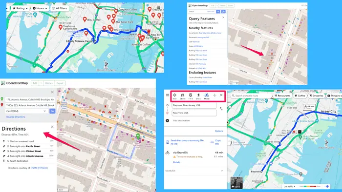
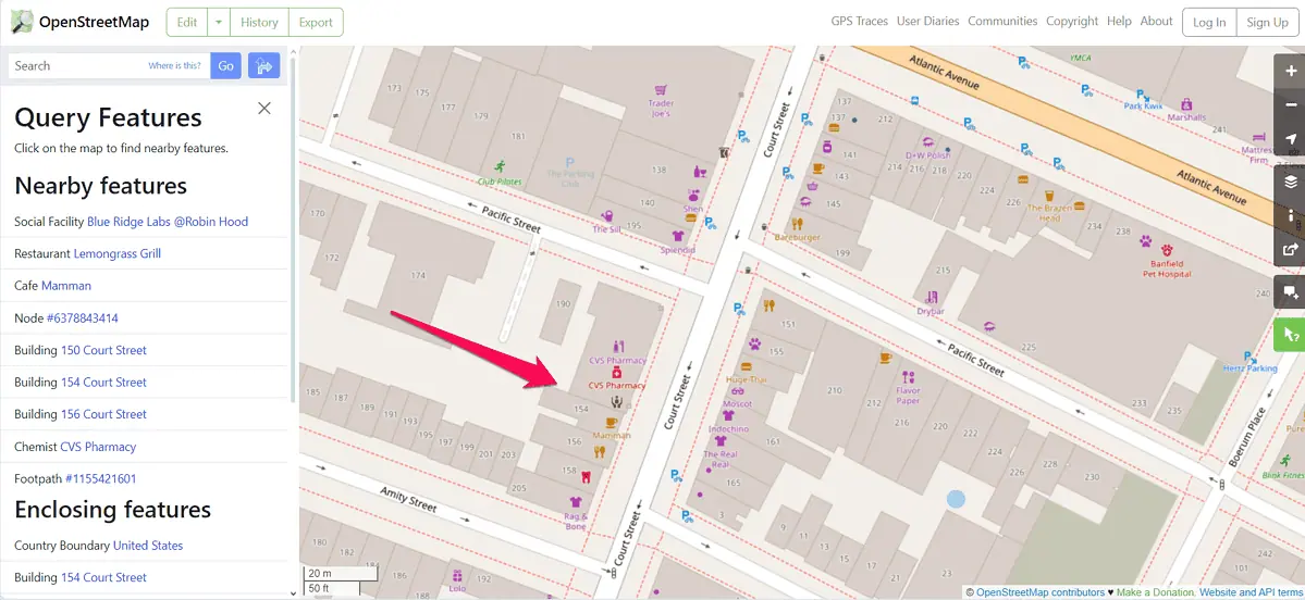
From the right side, you can access layers, map legend, and query features. The last one is an outstanding feature that lets you see the smallest items on a map such as park benches, fountains, and streams.
This level of detail is truly impressive, which can be seen from the OpenStreetMap’s legend too. It shows main roads, motorways, bridleways, and cycleways. The map also displays lakes, glaciers, bridges, tunnels, and nature reserves.
However, familiarizing yourself with OSM takes some time. As highlighted in the OpenStreetMap vs Google Maps comparison table above, the map dataset wasn’t created with an average internet user in mind. Google Maps, meanwhile, was.
For that reason, you can easily browse through Google’s navigation app. From switching map layers and types to exploring transportation modes and adding route stops – it’s all very intuitive.
With that in mind, Google Maps is a winner regarding ease of use.
Map Coverage
Another important aspect worth considering is map completeness.
There’s no precise data about the OpenStreetMap coverage, but it’s estimated that the platform covers 83% of the world. Its main source of data is its users, who make an average of 1.75 million contributions over a three-month period.
Additionally, OSM leverages satellite imagery from Yahoo and Microsoft. The free map of the world also gets data from humanitarians who strive to provide accurate data in places hit by disasters.
Google Maps, on the other hand, has higher coverage, spreading to over 220 countries and territories. The navigation app gets the data from over 1,000 sources, including local governments, app users, and geological organizations.
In comparing Google Maps vs OpenStreetMap map quality, the former has better coverage in urban areas, while OSM does a better job in areas where it has an active user base.
Route Planning and Customization
Both platforms allow users to plan their routes using different transportation modes.
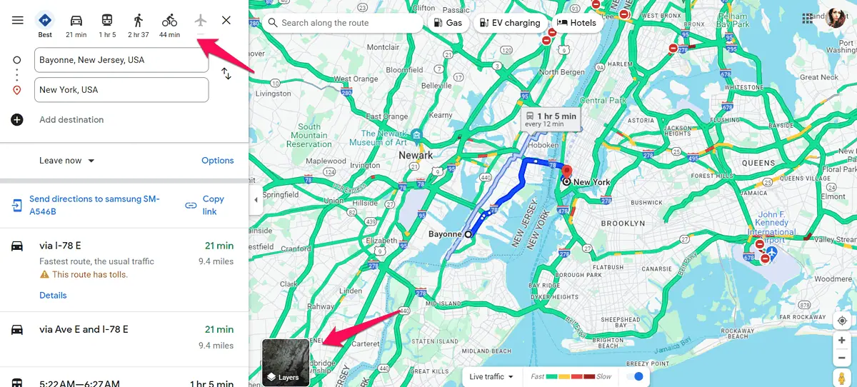
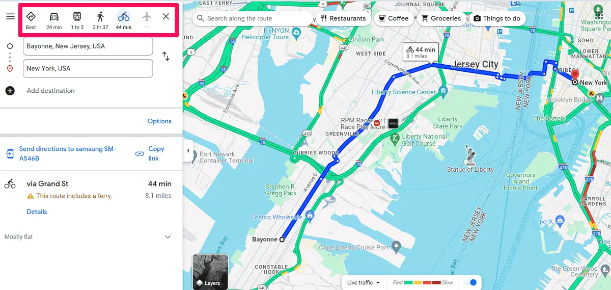
Google Maps has the upper hand here, supporting all kinds of transportation. You can use it to plan your trips via car, public transit, and bicycle. For longer trips, Google’s navigation app displays flight information. And you can always explore areas on foot.
OpenStreetMap, meanwhile, lets you plan your route via car, bicycle, and on foot.
The platform has a Transport layer, but you can’t use it to plan a route via bus or train. In Google Maps, you can easily do that.
Speaking of layers, both services let you turn on the default map style, and view bike routes. Meanwhile, Google Maps also lets you switch your map to the satellite view, access live traffic information, and explore areas using Street View.
When it comes to route suggestions, Google Maps shows the best route by default. The app also offers multiple route suggestions.
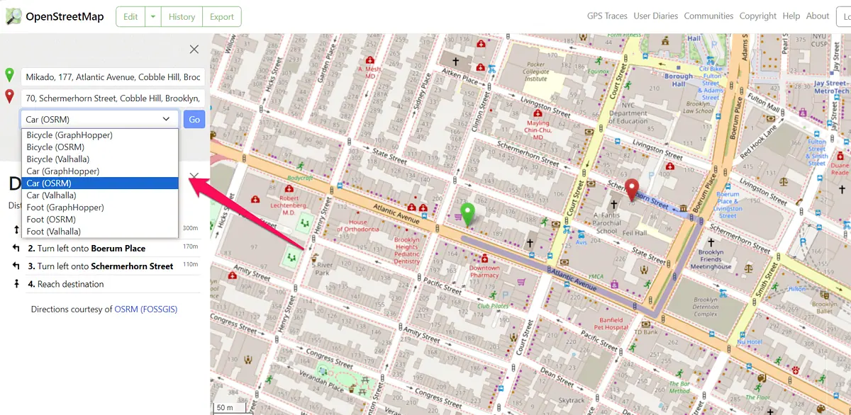
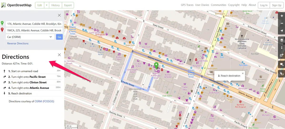
OpenStreetMap, on the other hand, shows you how to get from point A to point B. It offers a single route suggestion, based on the routing engine and algorithm you choose.
There are three of them, including the following:
- GraphHopper
- OSRM
- Valhalla
However, if you want to add stops to your route or search places along it, you can’t do that in OSM. These are the features that only Google Maps offers.
OpenStreetMaps also lacks route filtering options. For instance, you can’t search for a route that excludes tolls or highways.
Another Google Maps feature is points of interest such as cafes and shopping malls, which show helpful business information. Users who visit these places leave reviews and images, which makes exploring new areas more fun.
On the other hand, these same points of interest contribute to a somewhat cluttered map view. And if you want to remove POIs in Google Maps, you’ll have to do a lot more than just turn this feature off.
OpenStreetMap doesn’t have this problem. The map service displays cafes, fitness centers, and other points of interest, but they’re shown more subtly.
Despite OSM’s advantages like the one above, Google Maps offers more features for planning and customizing routes.
Now, let’s look at how these two compare in the navigation department.
Navigation
OpenStreetMap is a geographical database and as such doesn’t offer voice navigation. It can get you from one place to another and provide turn-by-turn directions.
Google Maps, on the other hand, supports both turn-by-turn directions and voice-guided navigation.
You can customize voice navigation by setting the voice language and volume, as well as connect it with Google’s Assistant.
Google Maps also dominates in the traffic arena because it provides up-to-date information. You can see both typical and real-time traffic data. OSM, meanwhile, doesn’t have traffic data.
With that in mind, Google Maps is a better fit for users who want to get features like voice-guided navigation and real-time traffic updates.
Offline Maps
Being able to download and use maps offline is an essential feature for navigation platforms.
You can download the map you need and use it offline with both OpenStreetMap and Google Maps.
OSM is more flexible, though. With Google Maps you can select the area you want to download.
OpenStreetMap lets you download a small portion of any area, but you can also download the map of the entire planet. That way, you don’t have to worry about poor internet connection or exceeding your mobile data limits.
In this round, OpenStreetMap is a clear winner.
Mobile Apps
When it comes to mobile apps, it’s not possible to compare OpenStreetMap and Google Maps. OSM doesn’t have a mobile app, even though many navigation apps use OSM data.
By contrast, Google Maps has a user-friendly app available to Android and iOS users.
The app has all route planning and navigation features and lets users explore areas on the go.
OpenStreetMap vs Google Maps – Verdict
Now that we covered the core features of these two platforms, the question is: Is Google Maps better than OpenStreetMap? The answer depends on your requirements.
If you’re looking for an easy-to-use navigation app with accurate live traffic information, excellent route planning features, and voice-guided navigation, Google Maps is the better option.
However, suppose you’re looking for detailed area maps, unrestricted access to OSM’s entire geographical dataset, and want to help make a free map of the world. In that case, OpenStreetMap is unquestionably a better fit for you.
So, who is the OpenStreetMap vs Google Maps winner for you? Let me know in the comments!
Read our disclosure page to find out how can you help MSPoweruser sustain the editorial team Read more


Improve this guide


User forum
0 messages