How to Show Flight Path on Google Maps [Quick Guide]
![]() 2 min. read
2 min. read
![]() Updated on
Updated on
Share this article

Improve this guide
Read our disclosure page to find out how can you help MSPoweruser sustain the editorial team Read more
Looking for a way to show flight paths on Google Maps to see where you’re going to fly over? I’m here to guide you through each step:
How to Show Flight Path on Google Maps
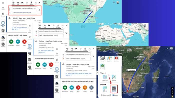
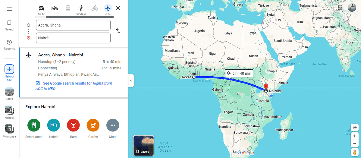
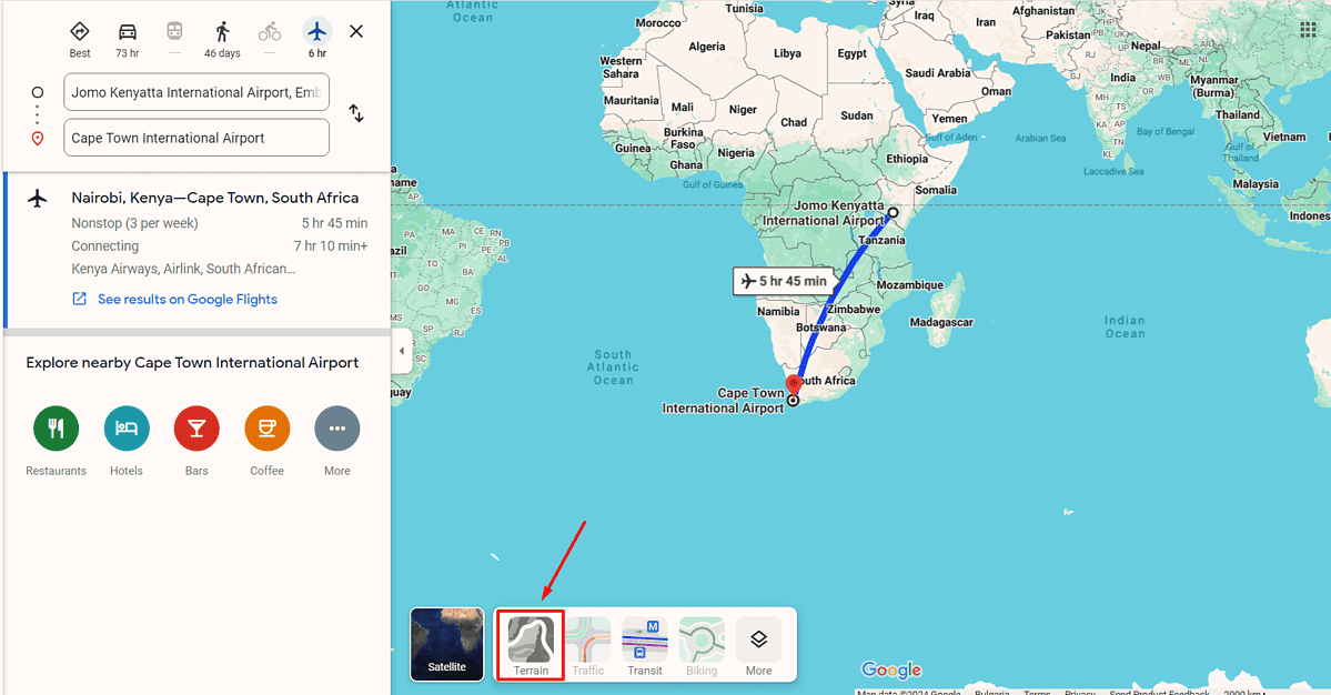
You can see your flight’s route using the Directions feature. Here’s how:
- Open Google Maps via your web browser or the mobile app.
- Click the directions button and type in your starting point and your destination.
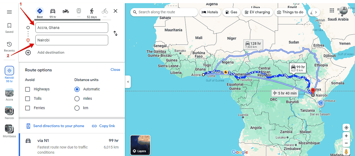
- Tap the airplane icon as your mode of transport.
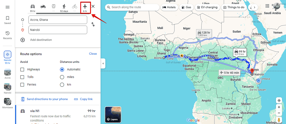
- Google Maps will automatically generate the flight path along with the estimated travel time.
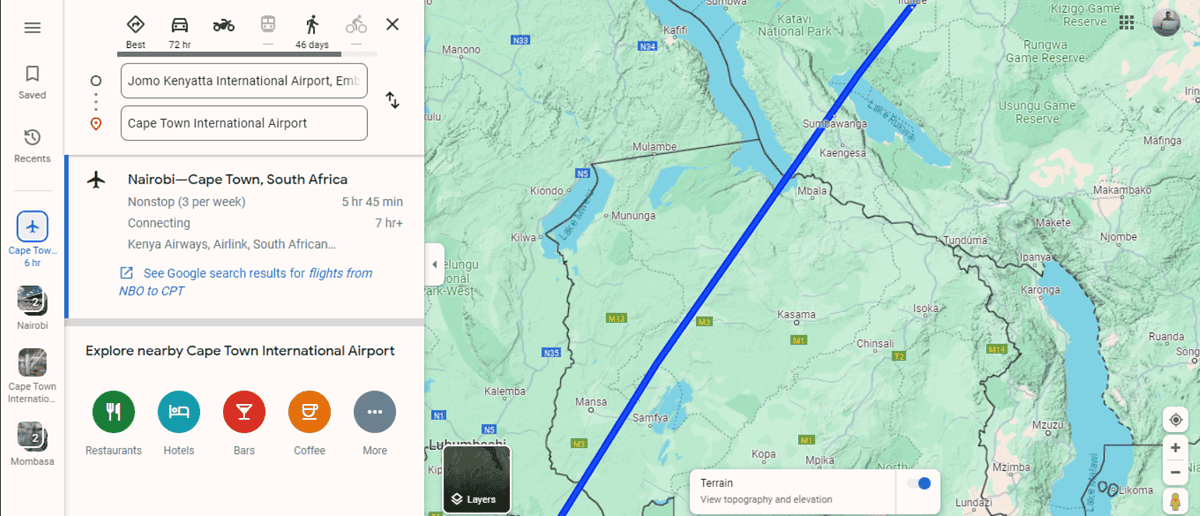
Google Maps Flight Path Tips
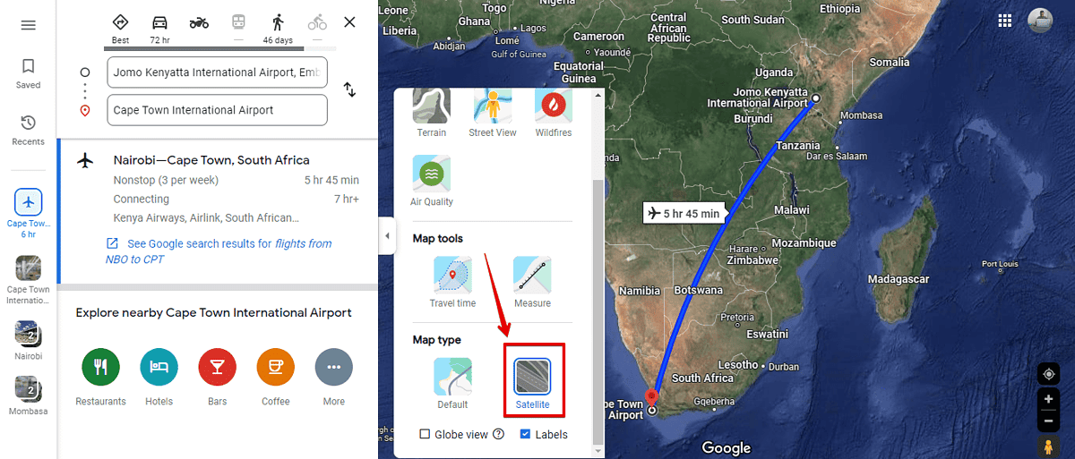
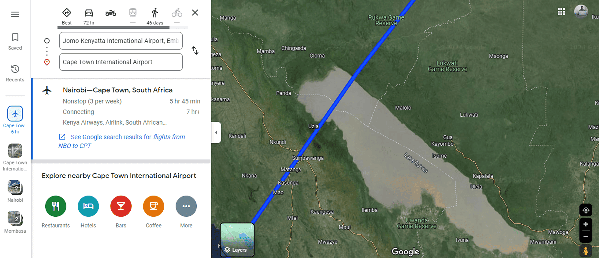
For a more engaging experience, switch to Satellite or Terrain view. This gives you a detailed look at the geographic features you’ll be flying over.
Use Satellite View
- Tap the Layers button in the lower left corner.

- Click More, scroll down, and select Satellite.
- Zoom to look at the earth’s surface in more detail. Tap the + icon on the bottom right of the screen to zoom, then drag to view different places along your route.
Use Terrain View
- Tap on the Layers button.
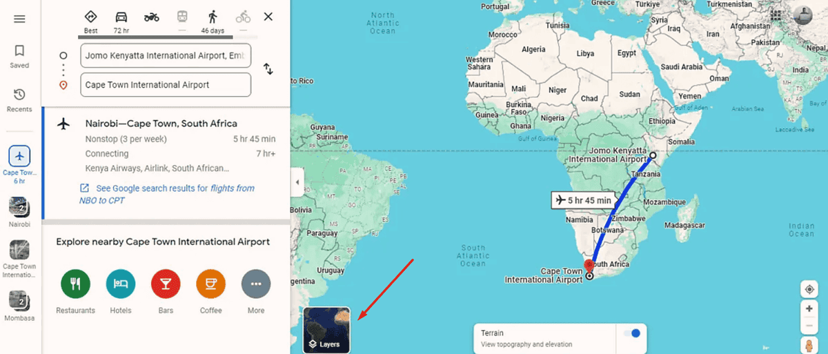
- Click the Terrain option.
- Click on the + button to highlight mountains, valleys, and plains in topographical detail.
Now you know how to show your flight’s path on Google Maps. You’ve also seen that experimenting with different map layers can make the experience more engaging. Was this quick guide helpful? Let me know in the comments!


User forum
2 messages