Google Maps update will soon let you know about transit station entrances, exits, and other details
Commuting can be one hell of an exhausting activity, especially if you’re new in the city. But, this latest Google Maps update will make things a whole lot easier.
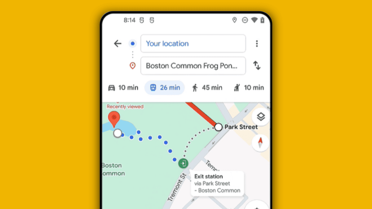
Rolling out in “the coming weeks” in select 80 cities worldwide including Berlin, Boston, London, Madrid, New York City, and Paris, you’ll see exactly where transit station entrances and exits are, what side of the street they’re on, and a clear walking route to and from them.
You can then sort it based on which lanes/routes have less walking distance, live crowdedness prediction, ETA, and more.
The popular app saw a healthy amount of AI features coming in the past few weeks. If you’re in a city where it’s available, you can use your phone’s camera to find information about nearby ATMs, gas stations, and stores.
Besides, the popular navigation app is also making it easier to share places, plan with friends, and vote on group activities.
In addition to saving places with emojis, you can now share a place with friends and create a collaborative list where everyone can add places and vote on them with emojis. You can even create mashup reactions thanks to AI and Emoji Kitchen.
Read our disclosure page to find out how can you help MSPoweruser sustain the editorial team Read more


Improve this guide


User forum
0 messages