Now you won't lose your GPS tracking inside tunnels on Google Maps; to utilize Bluetooth beacons
Google Maps has recently introduced a new feature utilizing Bluetooth beacons to enhance navigation accuracy within tunnels, historically a challenge for the app due to GPS signal limitations.
Bluetooth beacons are small devices strategically placed within tunnels that transmit radio signals. Smartphones with the appropriate software can detect these signals, allowing them to pinpoint their location even when GPS is unavailable. This translates to a seamless navigation experience for drivers traversing tunnels, continuously displaying their position on the Google Maps interface.
The primary benefit of this technology is improved location accuracy in tunnels, eliminating the frustration of losing GPS signals and ensuring consistent navigation guidance. Additionally, the potential for enhanced safety arises from access to real-time information about traffic and potential hazards within the tunnel environment.
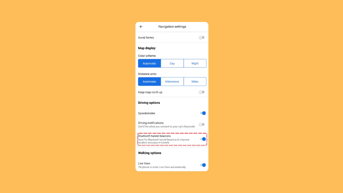
Currently, the Bluetooth beacon feature is being rolled out for Google Maps on Android devices. Availability on iOS is yet to be confirmed. To activate the feature, users can navigate to Settings > Navigation settings > Driving options within the app and locate the toggle switch labeled “Scan for Bluetooth tunnel beacons to improve location accuracy in tunnels.”
This development undoubtedly improves the overall navigation experience and opens doors for potential safety benefits associated with real-time information access in tunnels.
More here.
Read our disclosure page to find out how can you help MSPoweruser sustain the editorial team Read more


Improve this guide


User forum
1 messages