Google's new COVID-aware Google Maps will help you avoid the plague

There are clear signs we are due for a second wave this winter, but Google is ready to help you avoid accidentally entering areas awash with COVID-19.
Today the company introduced a new COVID-19 layer for their Google Maps app.

The layer shows critical information about COVID-19 cases in an area so you can make more informed decisions about where to go and what to do.
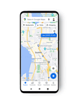
When you open Google Maps, tap on the layers button on the top right-hand corner of your screen and click on “COVID-19 info”. You’ll then see a seven-day average of new COVID cases per 100,000 people for the area of the map you’re looking at, and a label that indicates whether the cases are trending up or down. Colour coding also helps you easily distinguish the density of new cases in an area. Trending case data is visible at the country level for all 220 countries and territories that Google Maps supports, along with state or province, county, and city-level data where available.
Data featured in the COVID layer comes from multiple authoritative sources, including Johns Hopkins, the New York Times, and Wikipedia. These sources get data from public health organizations like the World Health Organization, government health ministries, along with state and local health agencies and hospitals. Many of these sources already power COVID case information in Search, and Google is now expanding this data to Google Maps.
The COVID layer starts rolling out worldwide on Android and iOS this week.
Read our disclosure page to find out how can you help MSPoweruser sustain the editorial team Read more


Improve this guide


User forum
0 messages