Google Maps Traffic by Time: What Is It and How To Use It?
3 min. read
Updated on
Read our disclosure page to find out how can you help MSPoweruser sustain the editorial team Read more
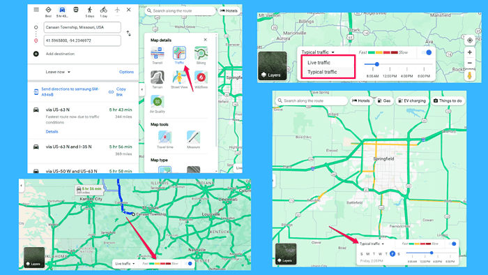
If you want to explore the Google Maps Traffic by Time feature, this guide is for you.
You’ll no longer spend hours stuck in a traffic jam, wishing you could predict the best time to hit the road. With this tool, you can analyze traffic patterns over time.
I’ll walk you through everything you need to know about leveraging this data. Let’s start, shall we?
What Is Google Maps Traffic by Time?
Google Maps Traffic by Time is a feature that provides insights into traffic conditions on specific routes at different times of the day. It uses historical and real-time data to estimate traffic congestion levels, allowing you to plan your journey more efficiently.
How Does Google Maps Traffic by Time Work?
The platform analyzes data from various sources, including GPS signals from smartphones, historical traffic patterns, and user reports. Based on this, it generates predictions about traffic conditions for different times and days of the week.
The navigation app uses different colors for different traffic conditions.
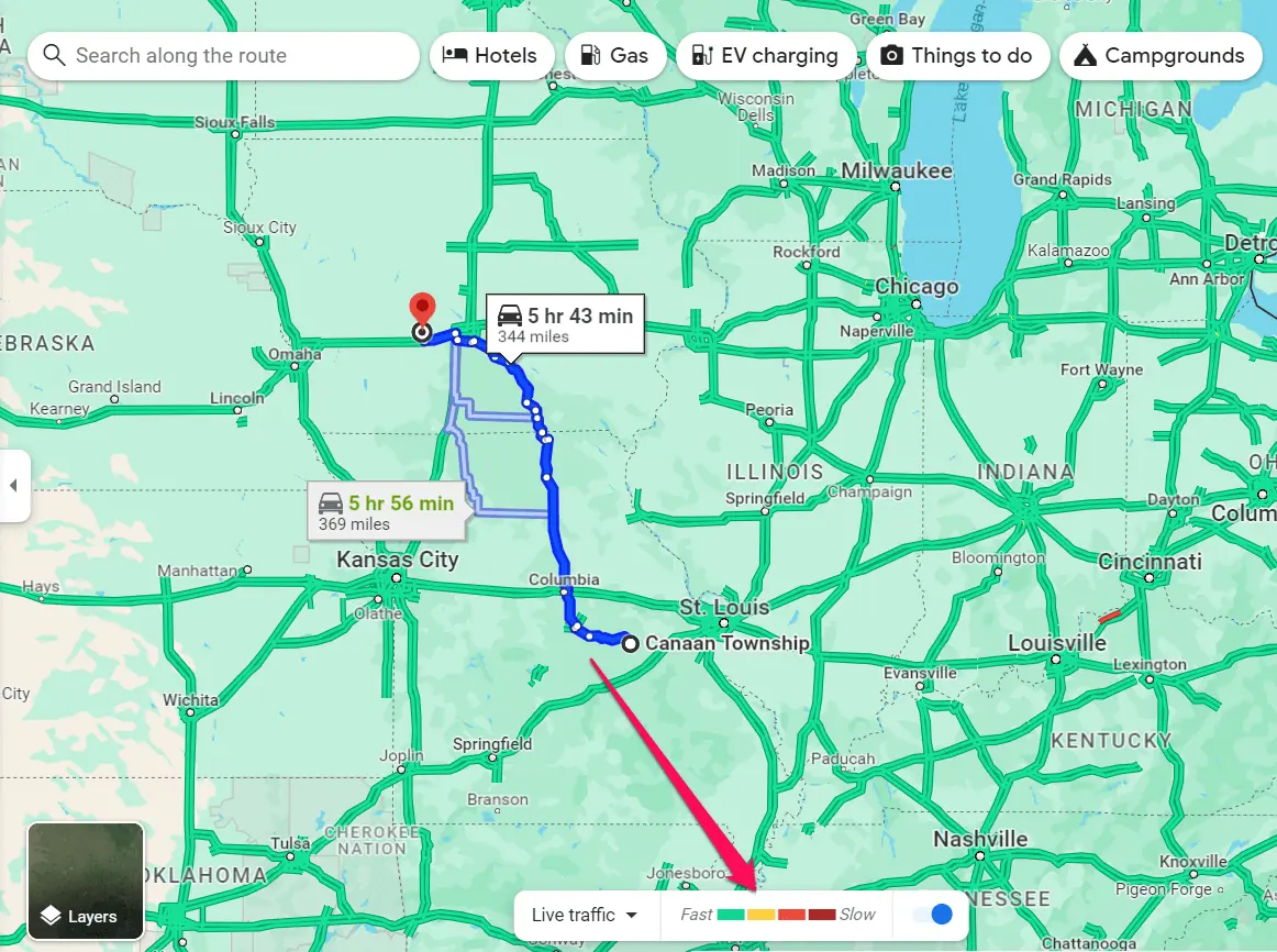
Here’s what the different colors mean:
- Green – traffic is flowing smoothly, with minimal congestion. This color typically represents areas where you can expect to maintain a steady pace without encountering significant delays.
- Orange – moderate traffic congestion, indicating slower speeds and potential delays. While you may encounter some slowdowns in orange areas, traffic is generally still moving, albeit at a reduced pace.
- Red – heavy traffic congestion, where speeds are significantly reduced, and delays are likely. In red areas, you can expect to experience slow-moving or standstill traffic, requiring extra time to reach your destination.
- Dark Red – severe traffic congestion, indicating extremely slow speeds and significant delays. In these areas, traffic may be at a virtual standstill, so you’ll have to consider alternative routes.
All this Google Maps data can help you minimize your commute time and schedule your activities.
How To Use Google Maps Traffic by Time?
Accessing traffic data is straightforward. Just follow these steps:
- Open Google Maps on your smartphone or visit the website on your computer.
- Type in your destination address to get directions.
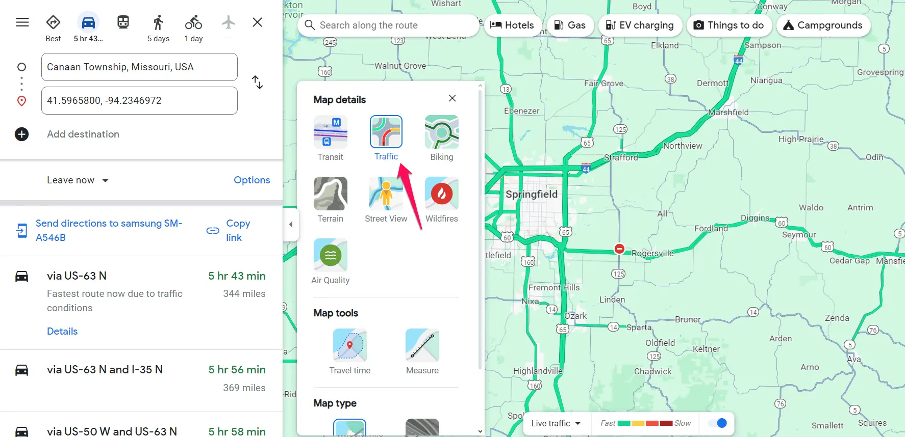
- Once your route is displayed, click on the “Layers” icon, and select the Traffic layer to see the current traffic conditions.
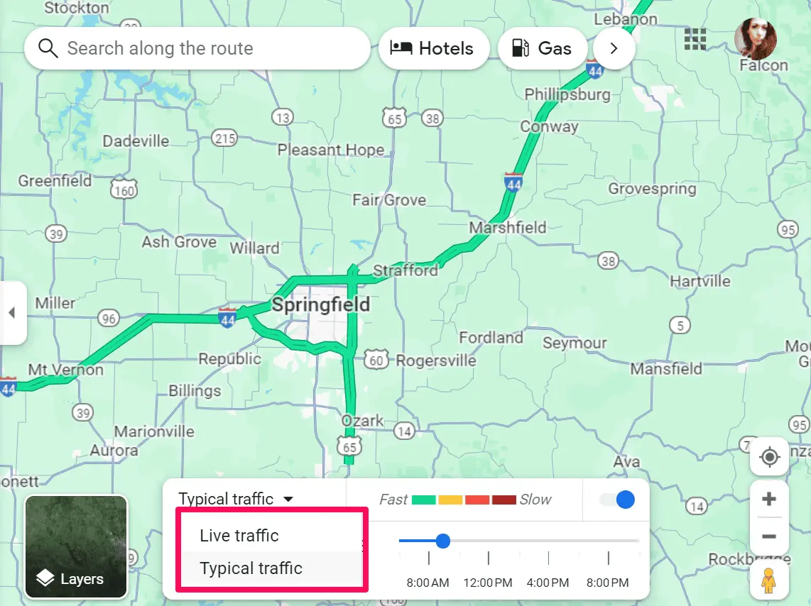
- To view traffic predictions for a specific time, switch to the Typical time view, and adjust the time slider to your desired departure or arrival time.
Based on these predictions, choose the best time to start your journey and avoid congestion.
Conclusion
Thanks to Google Maps Traffic by Time, you can make informed decisions about when to travel. Whether you’re dodging rush hour traffic or planning a leisurely weekend drive, this feature is your ultimate ally on the road. Safe driving!





User forum
0 messages