Red Lines on Google Maps - What Do They Mean?
Have you ever encountered red lines on Google Maps and wondered what they mean?
Here, you’ll find out all about them, including what they are, where they appear, and most importantly, how to use them to your advantage.
So, let’s start!
What Are the Red Lines on Google Maps?
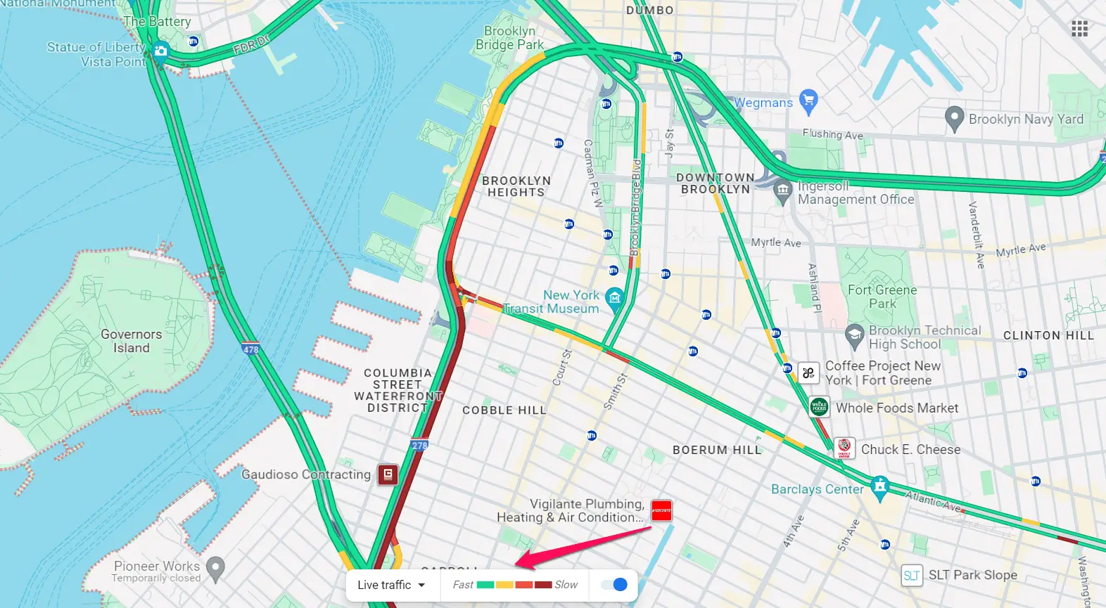
Red lines typically indicate traffic congestion or slow-moving traffic.
They can appear on roads, highways, or streets. The darker the red, the more congested the traffic is.
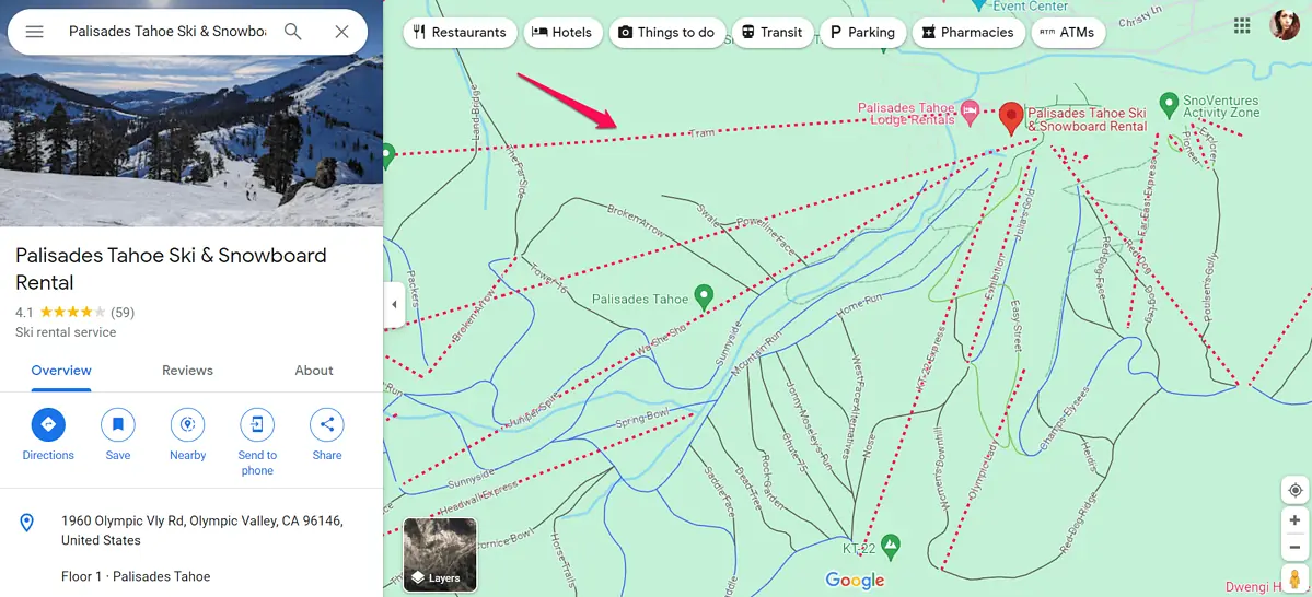
They also show ski lifts and boundary lines, but they’re dotted in this case.
The image below shows Palisades Tahoe, a ski resort in California.
This one shows the boundary of New Jersey.
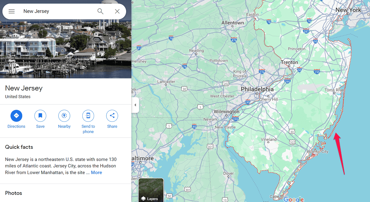
To view the border of any area, simply type in its zip code.
Now that you know what the red lines are, let’s see how they can benefit you.
How To Use the Red Lines on Google Maps To Plan Your Route
Here are a few ways to leverage these visual cues:
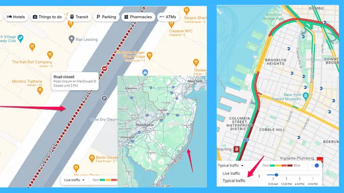
- Assess traffic conditions: Before starting your journey, take a moment to review the red lines along your intended route. Dark red lines indicate heavy congestion, while light red lines signify moderate traffic. Dotted red lines may indicate temporary obstructions or road closures.
- Explore alternative routes: If you encounter dark red or dotted lines on your chosen route, consider exploring alternative paths Google Maps suggests. They’re gray or light blue lines and can potentially have lighter traffic.
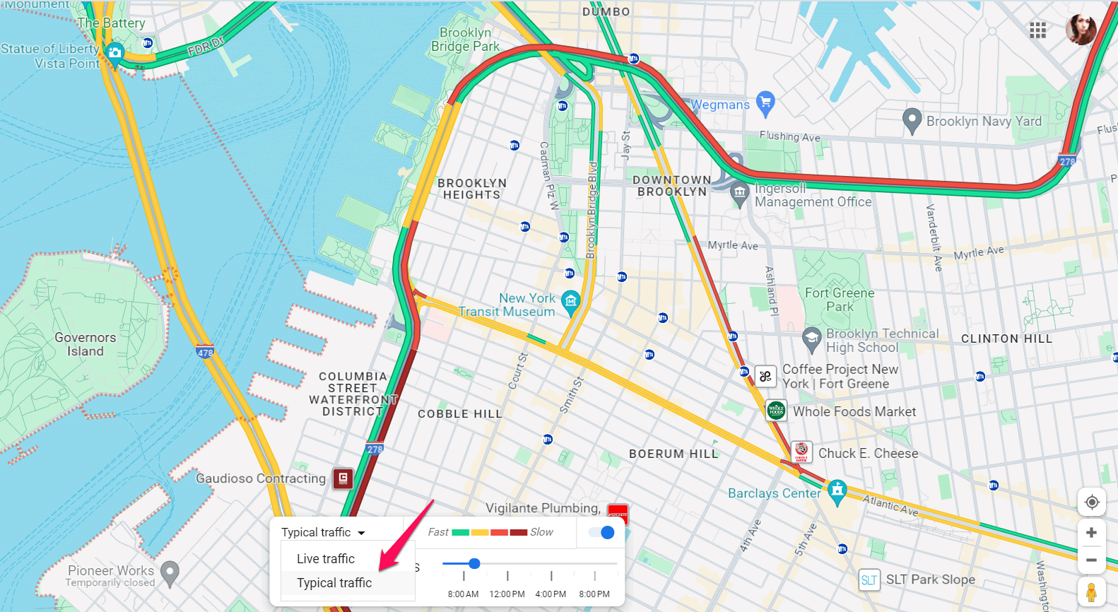
- Plan around peak hours: Red lines on Google Maps are more prevalent during peak traffic hours, such as rush hour in the morning and evening. You can use Google’s typical traffic data to plan around them. Turn on the Traffic layer and select Typical Traffic from the bar at the bottom of the map.
- Enable Live Traffic Updates: Take advantage of Google Maps’ live traffic feature to receive real-time updates. Enable this feature to follow any changes in traffic patterns, road closures, and anything else that may impact your journey.
Summary
In conclusion, red lines on Google Maps serve as visual indicators of traffic congestion along specific routes. By understanding what these red lines signify and implementing the suggested strategies, you can navigate traffic more efficiently and minimize travel delays.
Read our disclosure page to find out how can you help MSPoweruser sustain the editorial team Read more


Improve this guide


User forum
0 messages