Google Maps: How to Find the Flattest Route [Easy]
As an experienced technology writer and a passionate explorer, I’ve often tested the capabilities of Google Maps, especially when it comes to finding the most convenient routes for different needs.
Today, I’m focusing on a specific, yet commonly sought-after feature in Google Maps: finding the flattest route. This is particularly useful for cyclists, runners, or anyone looking to avoid hilly terrains for a smoother journey.
Let’s find out how you can use Google Maps to find the flattest route, combining my personal experience with the latest features of this app.
Why do You Need to Find the Flattest Route
The need for finding the flattest route is more than a preference, it’s sometimes a necessity. Cyclists and runners, for instance, often seek flat routes to avoid strenuous climbs and ensure a more consistent workout. For drivers, a flatter route can mean better fuel efficiency and a smoother ride. Google Maps, famous for its detailed and accurate mapping data, is perfectly equipped to assist in this task.
How to Find the Flattest Route on Google Maps
1. Open Google Maps: Launch Google Maps on your device. It’s crucial to have the latest version of the app for accessing all the newest features.
2. Set your destination: Enter your destination in the search bar. This could be an address, a landmark, or a general area.

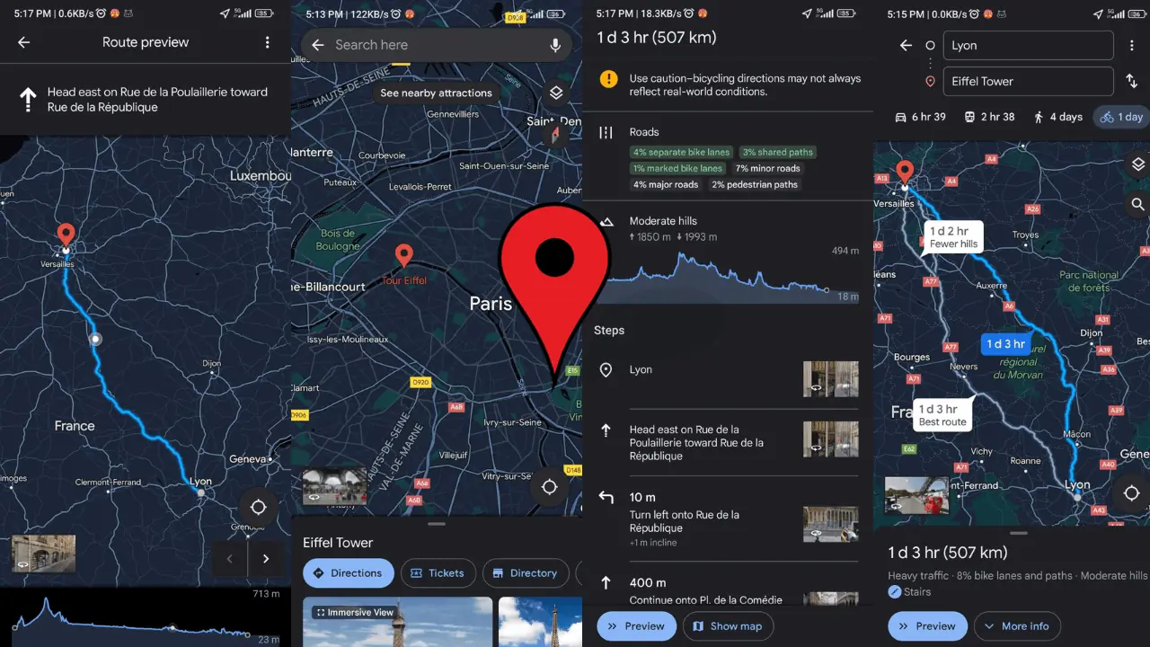
3. Choose your mode of transportation: Select the mode of transportation that suits your journey. The flattest route feature is particularly useful for cyclists, so you might want to choose the cycling option.
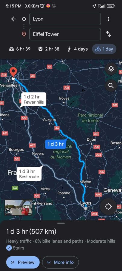
4. Inspect the route options: Once you’ve entered your destination and selected your mode of transportation, Google Maps will present various routes. Here, you need to look for the route options that offer the least elevation.
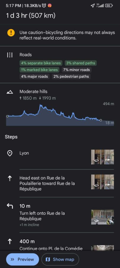
5. Check the elevation profile: Google Maps provides an elevation profile for cycling routes. Click on More Info to see each route’s elevation. This feature allows you to see the elevation changes along the route, helping you choose the flattest possible path.
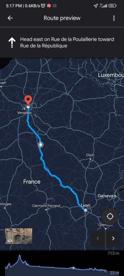
6. Select and start navigation: After comparing the elevation profiles of different routes, select the one that best meets your flatness criteria. Then, simply start your navigation.
Additional Tips
- Update Google Maps regularly: Google Maps is constantly evolving. Regular updates mean access to the latest features and improvements.
- Use Street View for a closer look: If you’re unsure about a route, use Google Maps Street View to get a sense of the terrain.
- Combine with weather and traffic features: For an even smoother journey, combine the flattest route feature with weather and traffic updates on Google Maps.
- Feedback is key: If you find discrepancies in the route’s elevation data, use the feedback option in Google Maps to report it. This helps improve the app for everyone.
More helpful resources:
- How to Remove Labels from Google Maps
- How to Fix Google Street View if it’s not Working
- How to Find Halfway Point on Google Maps
Finding the Flattest Route isn’t Hard
Finding the flattest route on Google Maps is a straightforward process that can significantly enhance your travel experience, whether you’re cycling, running, or driving. By following these steps and tips, you can make the most out of your journeys, avoiding unnecessary climbs and enjoying smoother rides.
Read our disclosure page to find out how can you help MSPoweruser sustain the editorial team Read more


Improve this guide

User forum
0 messages