Apple Maps 3D now available in London, Los Angeles, New York City, and San Francisco
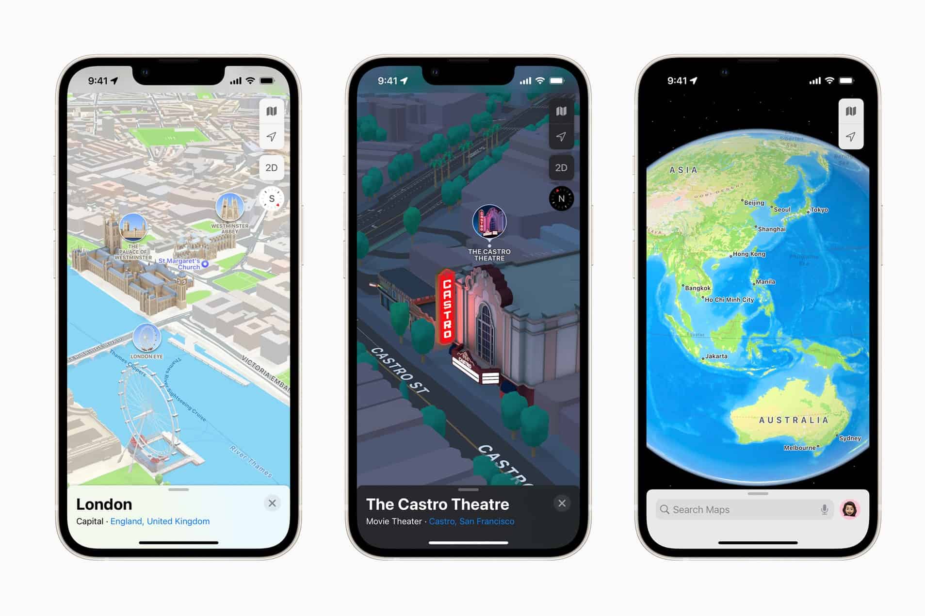
Apple today announced the availability of 3D view of maps in London, Los Angeles, New York City, and the San Francisco Bay Area. With 3D view, users can see elevation details across a city, new road labels, and hundreds of custom-designed landmarks including Coit Tower in San Francisco, Dodger Stadium in LA, the Statue of Liberty in NYC, and the Royal Albert Hall in London.
The latest Apple Maps update also brings more road details. Turn lanes, medians, bus and taxi lanes, and crosswalks are clearly displayed for navigating busy intersections, and highways with overlapping complex interchanges are rendered in a road-level 3D view. Also, the new Route planning feature offers the estimated time of arrival for future departures based on expected traffic.
Apple Maps now offers step-by-step walking guidance in AR. You can just raise your iPhone to scan buildings in the area, and Apple Maps generates a highly accurate position to deliver detailed directions that can be viewed in the context of the real world.
Other new features:
- Maps makes it easy to discover the amazing things to see and do in cities around the world through curated Guides created by a selection of trusted resources. In iOS 15, users can tap the Explore Guides button in Maps to access over a thousand expertly curated guides that include recommendations from respected brands such as Time Out, The Washington Post, the National Park Foundation, Complex, and The Infatuation.
- In iOS 15, Apple Maps offers a rich and interactive three-dimensional globe that introduces a whole new way of looking at the world. The globe shows Earth’s natural beauty with amazing textures and contours. Users can see vibrant details of mountain ranges, deserts, rainforests, oceans, and more. Now even the most remote and precious locations on the planet can be explored right from iPhone.
- Maps now offers major improvements for public transit riders. Nearby stations are prominently displayed at the top of the screen, and users can pin their favorite lines in Maps so the best route is just one tap away. Once a transit route is selected, Maps will automatically notify a user when it is time to disembark as they approach their final destination, and riders can even keep track on Apple Watch. These updates build on transit features already available in Maps, including real-time transit, which provides detailed transit schedules, live departure times, arrival times, the current location of a bus or train en route, and system connections to help plan a journey. Maps also includes important real-time information like outages.
Source: Apple
Read our disclosure page to find out how can you help MSPoweruser sustain the editorial team Read more


Improve this guide


User forum
0 messages