Nokia Updates HERE Maps Aerial Imagery For 14 million Of Sq.km Of Land Area
![]() 1 min. read
1 min. read
![]() Published on
Published on
Share this article

Improve this guide
Read our disclosure page to find out how can you help MSPoweruser sustain the editorial team Read more
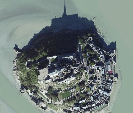
Nokia today announced that they are updating their aerial imagery for HERE Maps platform. Recently they updated street maps,and now their aerial imagery too. The update will be rolled out first on here.com with United States, Western Europe and South Africa, which make up 14 million of km2 of land area. They are planning to cover 90% of global landmass and later this year, they will be available on smartphones like Windows Phone devices too.
Nokia took a dig at Google on their recent announcement about cloud free maps,
While other companies are cleaning up their high level views, we’re providing clear, disruption free views on zoomed in levels with better resolution so that you can see more details and fresh maps with more recent images.
Read more about it here.