New Geospatial and Mixed Reality controls for PowerApps now generally available for experimental use
![]() 1 min. read
1 min. read
![]() Published on
Published on
Share this article

Improve this guide
Read our disclosure page to find out how can you help MSPoweruser sustain the editorial team Read more
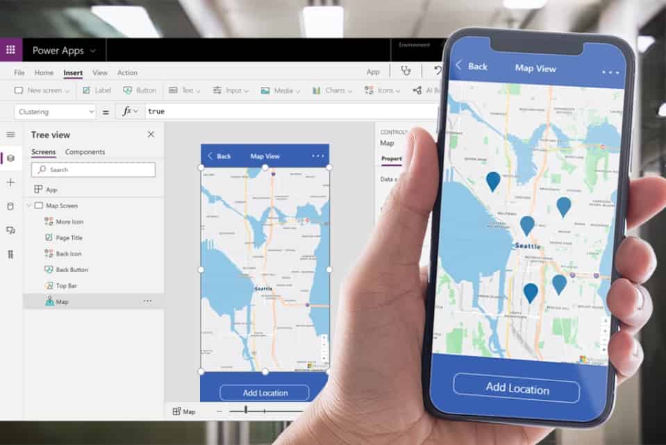
In April Microsoft announced that new geospatial features were coming to Power Apps. With these new features, app makers will be able to quickly introduce location-based capabilities into their experiences and start to digitize workflows in physical space using tools they are already familiar with.
These new components are powered by Azure Maps services, but you don’t need to be a professional developer to take advantage of these features. You can add these components with the ease of drag-and-drop and low-code development.
Controls include Interactive Maps, Address Suggestion, location-based data visualization and more.
The Geospatial controls can even be used in Mixed Reality, allowing developers to bridge the gap between your app and the real world – whether that’s working with geospatial controls, measuring spaces, or viewing 3D objects.
The controls are now available as experimental features to all.
See Power Apps Program Manager, Clay Wesener, demonstrates the controls below.


User forum
0 messages