GeoSpy AI Review - How Accurate Is Its Image Geolocation?
If you’re looking for a detailed GeoSpy AI review, you’re in the right place. Here, I’ll cover its features, pricing, ease of use, and demonstrate how to use it.
By the end of this review, you’ll have all the information you need to determine if it’s worth your time. So, let’s dive in!
What Is GeoSpy AI?
GeoSpy AI is an AI-powered geolocation tool that helps you determine the location from photos. To use it, simply upload the image, and it’ll analyze it to find its exact location on Earth.
The developers behind this tool are the folks at Graylark.io. It’s suitable both for experts to aid them in OSINT investigations and anyone who’s into geography.
GeoSpy AI uses advanced algorithms to analyze the image and identify key features such as buildings, signs, and lighting. Once the analysis is complete, it provides a detailed location description and approximate coordinates.
The latest version is v0.1.4. It includes a map and the option to “View on Google Maps,” which makes it easier to investigate the coordinates further. Additionally, it comes with new links to check out their active Discord, GeoSpy Pro version, and new API.
Features
1. Simple User Interface
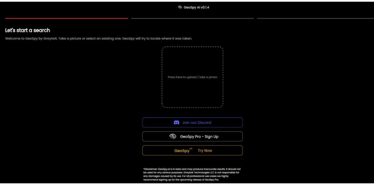
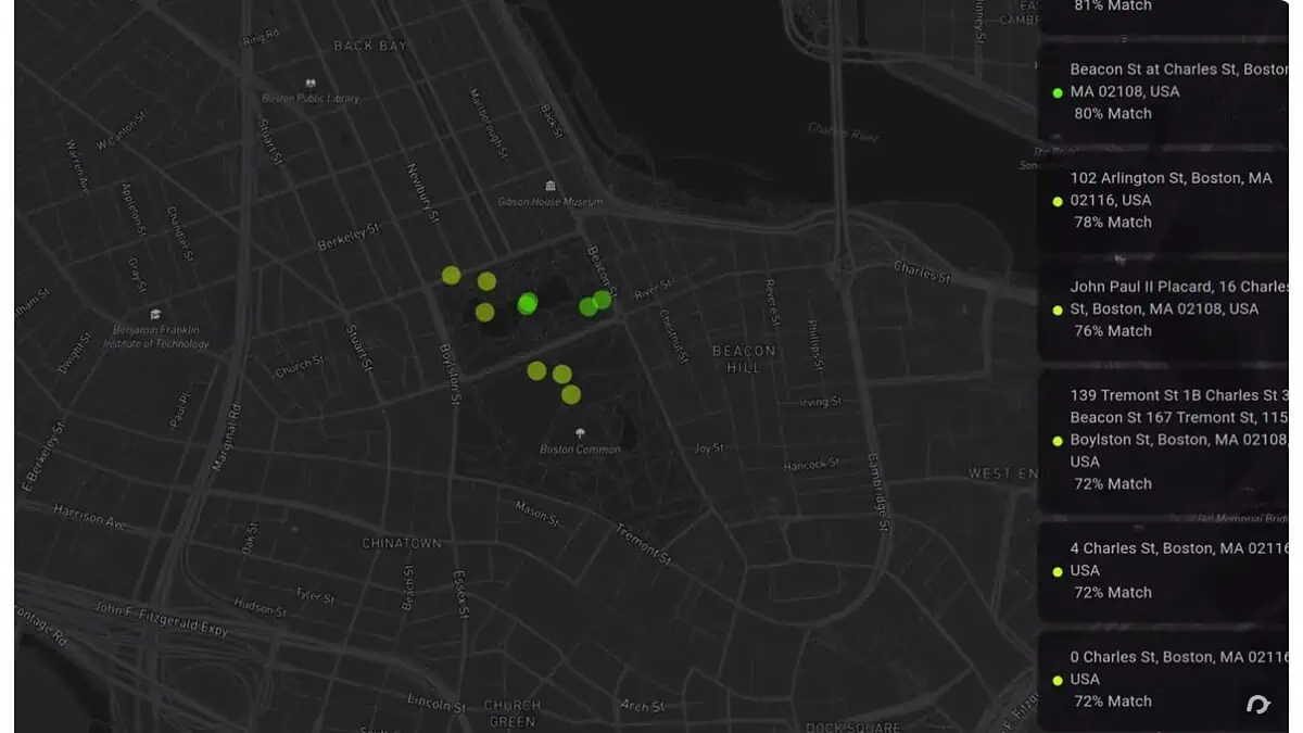
GeoSpy AI’s interface is simple yet effective. The geolocation analysis results are presented dynamically on a map interface.
2. Different Use Cases
GeoSpy can assist OSINT investigators in discovering hidden patterns, correlations, and connections in large quantities of data, including image location accuracy and tracking people on them.
It can also help confirm the accuracy of a photo’s location, making it especially useful for journalists. Moreover, students and individuals can use it to explore the world through geolocation software and satisfy their curiosity.
3. True Detective Analyze
GeoSpy AI delves deeply into the image to search for location clues. It’s like a detective with a magnifying glass, focusing on various aspects such as landmarks, vegetation, infrastructure, sky, and shadows.
The Grayclark.io tool looks for well-known buildings, iconic bridges, or unique natural features. It also identifies types of trees or plants peculiar to certain areas and examines road signs, distinct architectural styles, and even the shapes of power lines.
What’s more, it studies the clouds and the sun’s position to determine the time of day and the general direction. After comparing all these elements with a vast library of pre-tagged images, it can then accurately calculate the location where the photo was taken.
Picarta.ai is also AI-powered and can achieve the same things, but it isn’t as efficient. It was much slower during my tests.
Additionally, GeoImager can help you find out the location of your images and allow you to edit their location information. Moreover, you can add attributes like keywords, tags, and alternative tags. So, unlike GeoSpy, it’s focused on SEO optimization as well.

4. Using Contextual Clues
GeoSpy AI’s strength lies in its ability to employ contextual clues, such as signage, flags, license plates, and vegetation, to pinpoint the location.
It works better with more informative images with more detail. However, this tool isn’t always accurate and may only provide a general area, such as a large city.
Moreover, it can accurately identify typical landmarks but struggles with remote areas with less visual data.
Unlike GeoSpy, Wolfram ImageIdentify can recognize all objects in pictures, it’s not just focused on locations. It’s a free tool that’s based on the Wolfram computer language. Pic2Map is another free online tool that analyzes the EXIF data embedded within a photo. So, it’s not AI-powered like GeoSpy, but it achieves the same results.
5. Good Presentation of Results
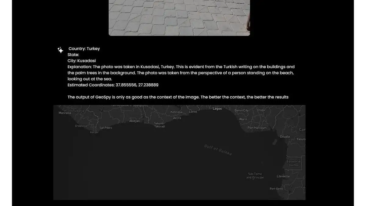
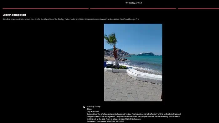
GeoSpy AI doesn’t act as a random guesser. It offers a well-calculated estimate that includes approximate latitude and longitude coordinates, a brief description of the area, and a map pinpointing the possible location.
In the example of a picture I uploaded from my private archive, GeoSpy AI correctly guessed the country (Turkey) and city (Kusadasi). As you can see, it also included approximate coordinates.
However, it made a mistake in another example.
I uploaded an image from my private archive showing the coast of Elbe near the town of Stade in Germany. The picture has the following specifications: 3024 x 4032 pixels and saved in JPEG format. I took it in bright sunlight.
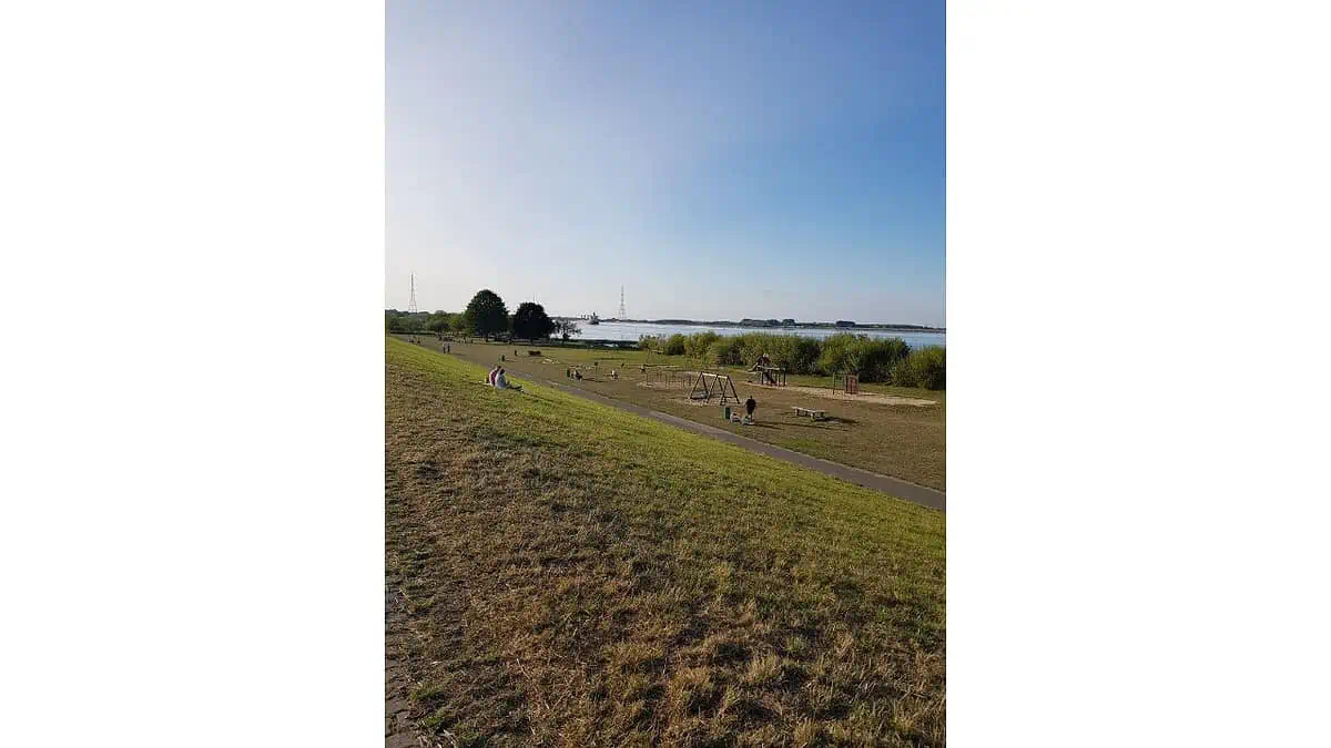
Unfortunately, GeoSpy AI got the state and city location completely wrong. Instead of the Stade in Germany, it said it was the Netherlands and town Krimpen aan den IJssel.
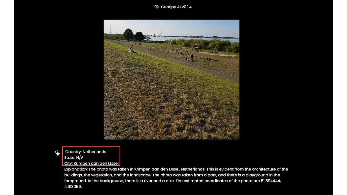
This shows how much a lack of helpful information can lead GeoSpy’s output in the wrong direction.
Let’s examine some scenarios where the service may face difficulties:
- If you take pictures of generic landscapes, such as deserts, fields, or coastlines that lack distinguishing features
- If you take indoor photos without unique architectural details
- If you use older images and the landscape has changed significantly since the photo was taken.
How To Use GeoSpy AI
I’ll show you how to use GeoSpy AI below:
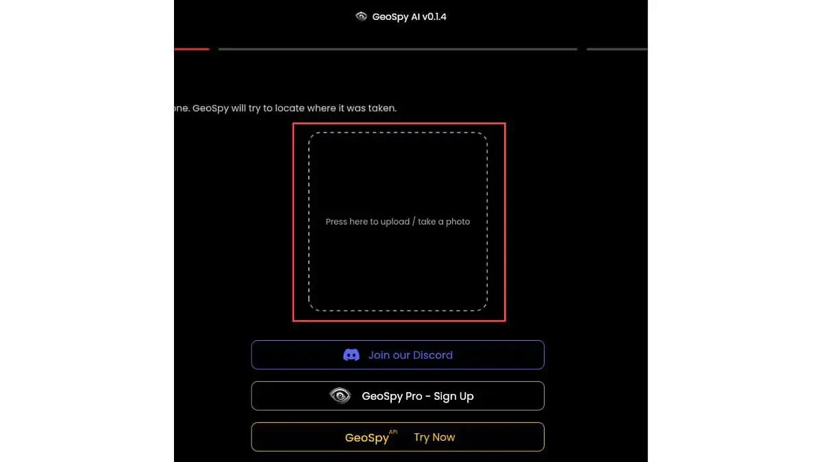
1. Open your web browser on any device and visit the official website.
2. Ensure that the images provide enough visual information so the app can understand them. You should only choose clear, high-quality pics.
For example, I’ll upload a photo I took while visiting Venice (Basílica de Santa María Gloriosa dei Frari.) The picture has the following specifications: 4032 x 3024 pixels, saved in JPEG format. I took it in bright sunlight.

3. Upload your chosen image to GeoSpy AI.
4. Please wait while it carefully analyzes the image to determine its location.
5. Finally, GeoSpy AI will present its findings on a map and in a descriptive manner.
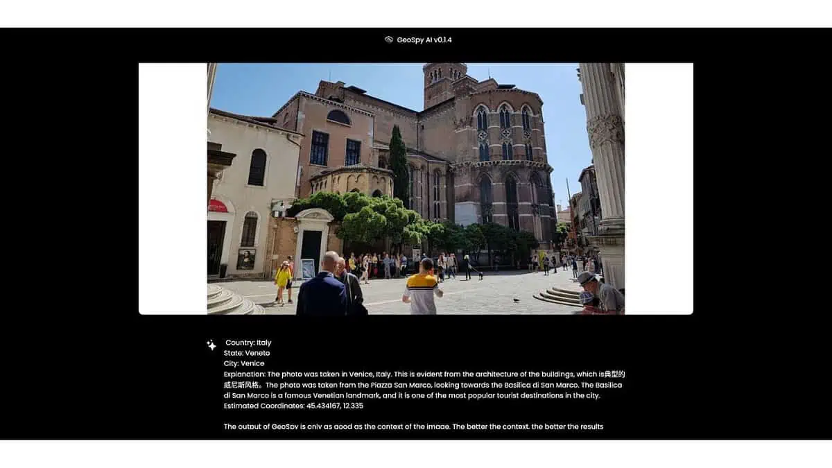
As a result, it correctly guessed the state and city but missed the object in the image. Instead of the Basílica de Santa María Gloriosa dei Frari, it guessed Basilica di San Marco.
Pricing
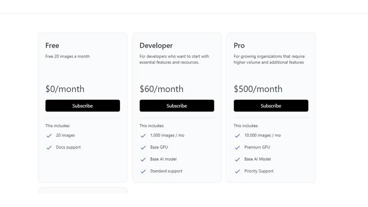
GeoSpy AI has a basic free version, while paid plans offer more extensive analysis features and a larger image analysis quota. GeoSpy AI’s monthly free plan grants you 20 images, a base GPU, a base AI model, standard updates, and community support.
Paid plans include:
- Developer at $60/month – 1,000 images, base GPU, base AI model, standard updates, and standard support.
- Pro is $500/month – 10,000 images, a premium GPU, a base AI model, standard updates, and priority support.
- Enterprise (custom price) – volume pricing, dedicated GPUs, custom AI models, custom integrations, and priority support.
Please note that GeoSpy Pro is exclusively available to authorized law enforcement agencies, government agencies, investigators, journalists, and enterprise users.
However, Grayclark.io’s website provides limited information about refunds. The GeoSpy API Terms of Service page outlines the company’s subscription policy.
If your API subscription expires at the end of its term, you can’t carry it over to the next billing period, transfer it to another service package, or refund it.
Additionally, it’s specific to the service package you initially purchased. Therefore, customers can’t claim a refund for expired GeoSpy API subscriptions. Except when required by law, paid subscription fees are non-refundable.
GeoSpy AI Review – Verdict
Overall, GeoSpy’s accuracy is hit-and-miss. It entirely depends on the image quality and the amount of valuable visual information in it.
Moreover, its paid plans may be expensive for ordinary users, which makes them more suitable for professional investigators. So, if you’re just curious and like spending a lot of time on Google Maps or are a researcher, you can rely on various free online tools.
Hopefully, this GeoSpy AI review has satiated your curiosity!
Read our disclosure page to find out how can you help MSPoweruser sustain the editorial team Read more


Improve this guide

User forum
2 messages