Apple Maps now offers 3D details in Montreal, Toronto, and Vancouver

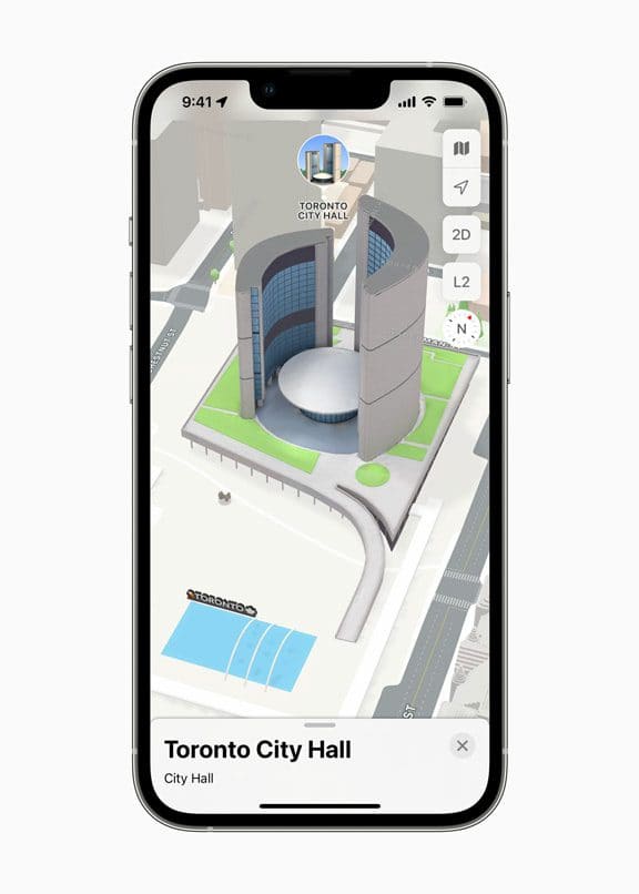
After adding a 3D view of maps in London, Los Angeles, New York City, and the San Francisco Bay Area, Apple now surprised us with the introduction of a three-dimensional city view for Montreal, Toronto, and Vancouver.
The update will allow drivers in the said cities of Canada to experience a new way to maneuver the place through augmented reality. The improvement will bring new features to current Apple maps users in the area, including details for road markings, land cover, trees, elevation, public transit routes, neighborhoods, commercial districts, marinas, buildings, and more.
“We’re excited for Apple Maps users to explore the beauty and culture of Montreal, Toronto, and Vancouver in an incredibly detailed new way,” said Eddy Cue, senior vice president of Services at Apple. “Built with privacy at its core, this update is the continuation of our commitment to building the best, most accurate map of the world — with a beautifully designed experience and attention to detail that only Apple can deliver.”
Some of the best features users can expect are the stunning nighttime mode with a moonlit glow activates at dusk and the elevation details in the monumental landmarks like Notre-Dame Basilica in Montreal, Robson Square in Vancouver, and Toronto City Hall.
Apart from the improved visual detail of Apple Maps, it is also expected to serve as a more practical tool in navigating through busy streets. Intersections will now include turn lanes, medians, bus and taxi lanes, and crosswalks, making it easier for drivers to comprehend the place on their phones. Apple also added that it will let users better learn the traffic situations and decide the right lane to choose via the road-level view when getting near the overlapping complex interchanges.
In addition, Apple underscores that the new update will also benefit riders of public transit due to the additional info offered to them during their trips via the real-time transit features. Some include the outages, detailed transit schedules, live departure times, arrival times, the current location of a bus or train en route, and system connections. In connection to that, Apple Maps will show stations close at the top of the screen while also allowing them to pin their favorite lines. Even more, it includes augmented reality guidance, which can be handy for those who want to explore the area by walking.
Read our disclosure page to find out how can you help MSPoweruser sustain the editorial team Read more


User forum
0 messages