Google Maps on Android and iOS gets new COVID-19-related features
2 min. read
Published on
Read our disclosure page to find out how can you help MSPoweruser sustain the editorial team Read more
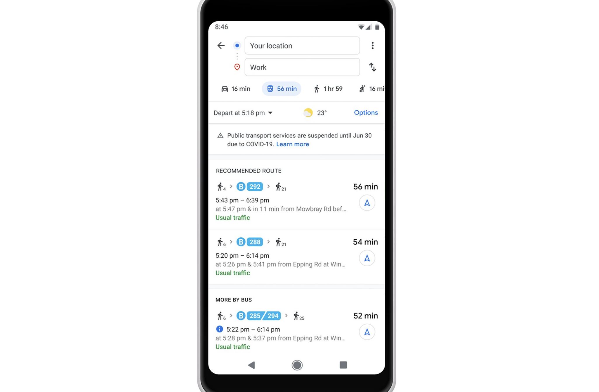
Because of COVID-19 situations around the world, people need to consider so many factors before their travel. To help people easily find important COVID-19 related information before they venture out, Google Maps is introducing new features on iOS and Android. Read about them below.
Alerts on COVID-19 information:
- When you find public transit directions that are likely to be affected by COVID-19 restrictions, Google will display relevant alerts from local transit agencies. Such Transit alerts are coming to Argentina, Australia, Belgium, Brazil, Colombia, France, India, Mexico, Netherlands, Spain, Thailand, United Kingdom and the U.S.
- When you are driving your car, Google Maps will not display COVID-19 checkpoints and restrictions along your route. This feature will be available first in Canada, Mexico and the US.
- When you search for medical facilities or COVID-19 testing centers, Google will remind you to verify eligibility and facility guidelines. The medical center alerts will be available in Indonesia, Israel, the Philippines, South Korea, and the U.S., and testing center alerts will be available in the US.

In addition, for public transit users globally, Google Maps will now provide insights like temperature, accessibility, security onboard, and designated women’s sections in transit systems. Also, you can now easily see the times when a transit station is historically more or less busy so that you can plan your travel accordingly.

Source: Google



User forum
0 messages