Microsoft Garage's Earth Lens app can be used to analyze objects in aerial imagery
![]() 1 min. read
1 min. read
![]() Published on
Published on
Share this article

Improve this guide
Readers help support MSpoweruser. We may get a commission if you buy through our links.

Read our disclosure page to find out how can you help MSPoweruser sustain the editorial team Read more
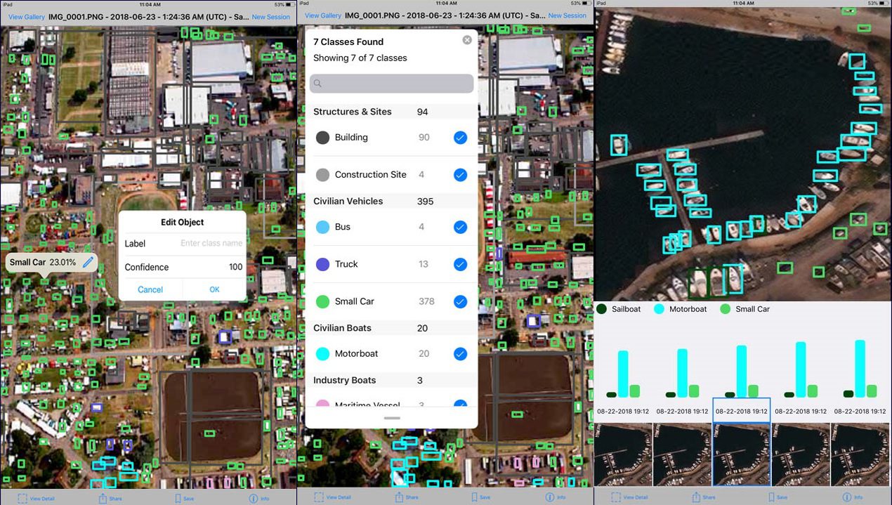
Earth Lens is a Microsoft Garage project that can be used to identify, track, and analyze objects in aerial imagery to assist in disaster relief and environmental conservation.
With this iPad app, you can automatically extract information from a large aerial imageryand have the analysis presented in a useful view.
- Automatically identify, classify, and label objects in satellite images, encircling like objects in color-coded bounding boxes
- Count and aggregate objects identified by the machine learning model
- Toggle classes on/off to focus in on specific objects
- View images over time alongside a data visualization chart to identify trends and patterns in a Time Series mode
- Use the app remotely, without an internet connection
Microsoft is also open sourcing this project that will allow researchers to make use of this code to build new apps similar to this one. You can learn more about this project here.
Source: Microsoft